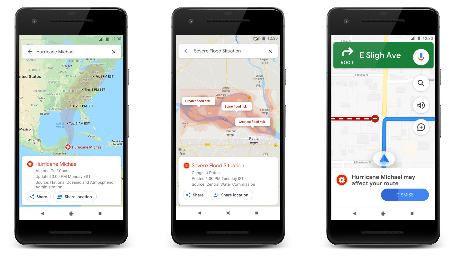
Google has offered SOS alerts for natural disasters since 2017, giving users quick access to emergency contact numbers, breaking stories, and other related information. Now, the company has announced that it'll be adding visual information to these SOS alerts in Google Maps.
The visual information includes the trajectory of floods and hurricanes, as well as earthquake visualizations. Google says it'll also issue crisis navigation warnings in Google Maps if it thinks your route might be affected by a natural disaster.
"Flood forecasts visualizations will soon roll out starting in India in the Patna area, and then expand to the Ganges and Brahmaputra regions on Android, desktop, and mobile web," Google noted in its blog post.
Meanwhile, hurricane forecast cones will be available in the U.S., Mexico, Caribbean, Western Europe, Japan, Taiwan, China, Philippines, Vietnam, Thailand and South Korea. Hurricane forecast cones will be accessible via Android, desktop, iOS, and mobile browsers.
Earthquake visualizations and crisis navigation warnings will be available on a global basis via Android and iOS (although the former will also be accessible on desktop and mobile browsers).
NEXT: Dynamic System Updates are now working in Android Q beta 4
from Android Authority http://bit.ly/2KwnBqW
via IFTTT
Related Posts :
 Google unveils Android 12L, tailored to tablets, foldables, and ChromeOS devices
- Intel announces new 12th Gen Core desktop processors based on Alder Lake architecture
- Zound announces three Adidas branded TWS earbuds
- Watch the Google Pixel 6 Pro battle it out with the iPhone 13 Pro Max in a speed test
- Asus is recruiting Android 12 beta testers for Zenfone 8 Flip
0 Response to "Google’s SOS alerts now let you see hurricane paths, flood trajectories, more"
Post a Comment